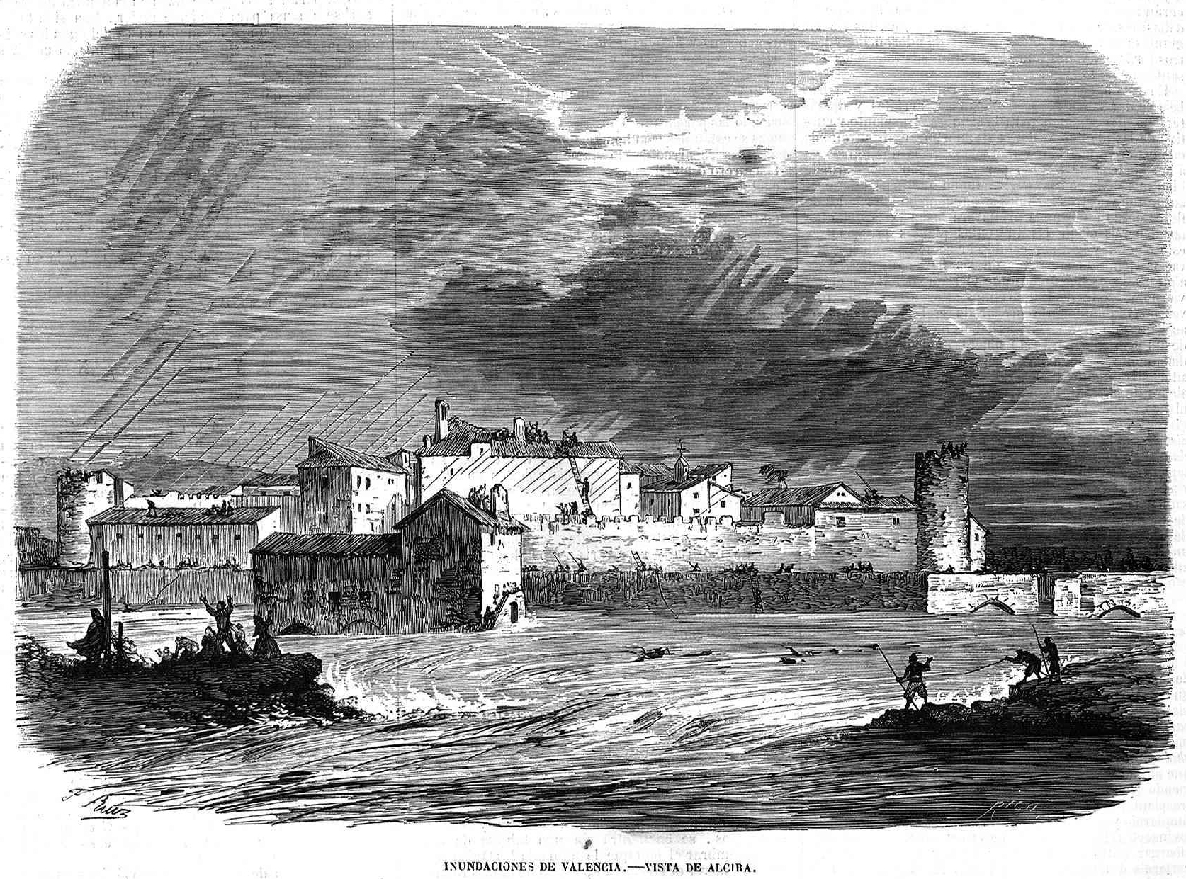
Frederico Ruiz, Inundaciones de Valencia, vista de Alcira, 1864. Originally published in El Museo Universal 8, no. 48: 380. The drawing reveals the scale and violence of flooding in Valencia Province, in Alzira, a city on the left bank of the Xúquer River, 45 kilometers to the south of Valencia in 1864. Wikimedia Commons. Public domain.
by Paul Josephson
On 29 October 2024, residents of the town of Paiporta (pop. 27,000), about eight kilometers from Valencia’s city center, saw a “tsunami” of mud and debris catapulting down toward them. At least 60 people died in Paiporta, and a total of 222 individuals died in the region. The area is prone to floods, with up to 75 recorded inundations in Valencia Province from 1483 to 1982, and noteworthy major events in 1897 and in 1957.
The immediate cause of October’s flooding was a DANA (the Spanish acronym for an Isolated Depression at High Levels), which results in heavy, almost stationary downpours. DANAs, that occur on the east of the Iberian Peninsula, are fed with humid air rising from the increasingly warm water of the Mediterranean Sea. Warm air holds more moisture than cooler air, and when Arctic air masses strike the saturated warm Spanish air in autumn, this results in “large convective clouds with heavy downpours and sudden flash floods.”
Precipitation from a DANA had pounded the region for days, and some observers worried about the overflow of the Turia River, which runs through Valencia (pop. 788,000). The Spanish State Meteorological Agency issued an alert in the morning of the 29th, but even as conditions worsened and streets filled with overflow, it took until after 20:00 that evening for the civil emergency service to instruct residents to shelter at home. Many areas received more than 300 precipitation liters per square meter (l/m2; 12 inches), and one town received 491 l/m² (20 inches) in just eight hours—the equivalent of a year’s worth of rainfall for this region. These downpours doubled the Turia’s flow, and the river breached its banks.
There are two critical, underlying reasons for the flash floods that are impacting larger and larger cities around the world with greater frequency and destructive power. One is global warming, which contributes directly to the intensity and duration of weather events. The other is overbuilt urban environments where—in the absence of zoning laws—concrete and asphalt have replaced greenery, and streets and sidewalks have thus been turned into channels for overflow. On top of this, many major cities are located in fluvial plains of rivers. In floods, signs, benches, and streetlights become fast-moving debris that, along with mud, plugs catchments. Flooding occurs due to several factors: torrential rainfalls,£1 which channel water into streets; the sealing of the soil under hard surfaces, which creates even greater runoff; and the inadequacy of storm and sewer systems. This phenomenon of heavy rain over impervious surfaces is overwhelming cities worldwide.2

Rebuilding the Landscape
In 1897, a flood shocked the residents of Valencia city. It was also caused by a DANA, leading the Turia to overflow its left bank, flood the old town of Campanar, as well as the neighborhoods of Les Tendetes, Marxalenes, La Saïdia, and La Trinitat. Sources report that there were no personal casualties, but the waters damaged hundreds of houses.
The flood of 14 October 1957 was a call to action. It caused extensive property damage and 81 official deaths, although perhaps as many as 300 people died; the Francoist government would not permit public reports that revealed state failure. In response, the authorities adopted the Southern Project (Plan Sur) to protect the city center.3 Massive construction crews moved 10 kilometers of the Turia River to the south of the city. The plan was also intended to promote urban development, including the construction of high-rise apartment buildings and roadways in the former riverbed. The Turia Garden greenway that fills the space the river left was approved only after citizens successfully mobilized against Francoist urban plans.4 The Turia flood-control measures included the creation of regulating reservoirs and diversion canals that enable the river to carry significantly higher volumes than that of the flood discharge of 1957.
Carried out between 1965 and 1972, the Plan Sur ended up costing seven billion pesetas, with an initial budget of two billion pesetas (approximately 7.5 billion US dollars in 2024). Valencia’s city and provincial councils were responsible for only 25 percent of the budget, which required the municipalities to place surcharges on products, postage, and local taxes—a series of measures that were “highly unpopular.” Yet like other dictatorships that had advanced grandiose construction projects such as canals and hydropower stations to publicly demonstrate their omniscience and brilliance, so too did Francisco Franco support waterworks, especially in the postwar years. On 16 June 1962, Franco visited Valencia to celebrate the new buildings, roads, and the rerouted Turia, although the official opening did not take place until 22 December 1969.
Civil engineers and agricultural scientists had hopes then as now that their projects for hydraulic improvements would serve the Spanish people through irrigation, flood control, and power generation. They willingly participated in the country’s Francoist forced modernization in industrial, agricultural, and hydrological projects such as Plan Sur.5 In its 1971 annual report, the Minister of Public Works, Gonzalo Fernandez de la Mora, proudly announced that Spain was “third in the world for the number of its large dams … with a reservoir capacity of 37,000 million cubic meters and which double the capacity available in 1950 … In 1945, 1,400,000 hectares were irrigated. Today, 2,400,000 hectares are irrigated, i.e., the figure has almost doubled.” The Francoists boasted about harbor improvements, water transfer, and irrigation projects, reservoirs, and viaducts. Yet, as endemic urban flooding indicates, these problems are no guarantee against extreme-weather events in a time of global warming and increasingly intense storms.
Urban Flooding
Floods have become an all too frequent urban phenomenon, with the building of roads, factories, and housing along rivers making many river-catchment surfaces impermeable. Costly efforts at flood control can also exacerbate the situations that engineers and officials hope to ameliorate; levees and technological fixes that force water into narrower channels turn 100-year floods into 50-year events, and 50-year floods into 10-year events.6 Infiltration is reduced, runoff volumes increase, and drainage networks (drains and sewers) are easily overwhelmed in storms. Floods are now the most common extreme-weather event and the leading cause of extreme-weather fatalities worldwide. From 1980 to 2009, there were roughly 540,000 deaths, 362,000 injuries, and hundreds of millions of people affected due to floods around the world.7 One event in and around Mumbai on 24 July 2005 killed well over one thousand people. Flood hazards have increased in frequency and magnitude in Global South cities as well,8 and for similar reasons to those in Europe and the US—primarily land use with inadequate controls to preserve green spaces and incomplete coordination among government departments.
The video clips of mud pouring through streets in Paiporta confirms another aspect of urban flooding: It is generally a phenomenon exacerbated by infrastructure. Sixty percent of urban-flooding deaths are related to vehicles, to the fact that urban planners work hard to facilitate automobile transportation through newer and wider roadways—and to overconfident drivers who get stuck and swept away.9 Moreover, in the Global North, being in a motor vehicle and male is associated with increased mortality, whereas females are more likely to perish in floods in low-income countries. Once road, utility, rail, and underground rail systems are built, they, too, require flood defenses for protection. In August 1994, torrential rain and flooding accompanying a thunderstorm over central London led to the closure of 29 underground stations and stranded 60,000 passengers. After the Valencia October DANA, the metro and other transportation systems were closed due to the flooding for over one month.
The Geography of Risk: Valencia
The impact of the DANA in Valencia highlights the risks of all of these engineering practices and meteorological phenomena coming together. Until the completion of Plan Sur, Valencia was a disorderly, rural city with conspicuous road and railroad crossings. The rebuilding of the Turia River accelerated significant physical and social changes. It contributed to urbanization toward the new riverbed south of the city, although planners forecast urbanization to the north. It swallowed up 337 hectares of land, as orchards, farms, and farmhouses gave way to streets and other physical and psychological barriers that separated the city from its southern districts. Industrial and commercial sites filled the floodplain.
The la rambla del Poyo, a seasonal watercourse located between the Turia and Júcar rivers and the Picasent Ravine, runs for more than 40 kilometers until it flows into the Mediterranean Sea. Dry for much of the year, it is the major outlet for rains in the region of Paiporta, Torrent, and other towns. Although DANA rains in October 2024 were relatively light in Paiporta, Picanya, Sedaví, Alfafar, and Massanassa, heavy downpours elsewhere funneled water into the area, and the ravine overflowed. Engineers have long lobbied to build the Vilamarxant Dam for enhanced flood control—even before the Southern Plan (Plan Sur)—and have continued to push for the project to ensure sufficient upstream capacity to manage a flood of the magnitude of 1957. But it has not been built due to its high costs; a number of environmental organizations oppose its construction both because of cost and significant inundation.

In Paiporta, the ravine’s flow reached 2,300 cubic meters per second (m3/s) but is only meant to hold 1,800 m3/s. The funneling problem is exacerbated by the buildings, the infrastructure, and the 13 kilometer-long Pista de Silla (Silla Road or V31 highway) that cuts off the natural outlet of the watercourse before it reaches the sea. The force of the water damaged the roadway, sent vehicles out of control, and trapped drivers in them. The sediment-, debris- and corpse-laden floodwaters eventually emptied into the Balearic Sea (part of the Mediterranean) and the Albufera coastal wetlands. The S’Albufera de Mallorca nature reserve (established in 1986) suffered severe damage. Tons of waste ended up in this wetland, and searches continue for missing persons, especially along the coast.
Scores of people died in Paiporta when the torrents of mud cascaded through the area, destroying buildings, ripping out light posts and benches, and swallowing up people. The muddy aftermath left survivors in a critical situation: The sewage system clogged with mud after a week of cleaning out houses and underground car parks, while running water, electricity, gas, and internet were all disrupted. Thousands of people were displaced, and many of them are still without housing.

Coping with Global Warming in Urban Environments
Urban waterworks are a blessing and a curse. They saved cities in the nineteenth century by supplying clean water and carrying away sewage in the fight against the plague and other epidemics. The battle against urban blight and disease also manifested in wide tree-lined boulevards and parks. But today’s overbuilding in a time of climate change requires new attitudes toward city planning.
As the floods in Spain and elsewhere demonstrate, city residents must be better prepared for the next violent extreme-weather event and confrontation with water, mud, and debris. Over half of the world’s population is urban. Sustainable urban planning for green infrastructure and improved drainage systems is vital to lessen the chance of major floods. Early warning systems, emergency-response planning, and community engagement must be a part of preparedness. City planners and citizens should insist on such simple spatial constraints and improvements like green pedestrian malls and bike paths, which could be joined to building codes to preserve soil and mitigate population densities. And, of course, as leading specialists have urged for decades now (the Intergovernmental Panel on Climate Change, UN COP initiatives, and so on), the governments of the world must address the problem of cities as both major contributors to climate change and among the places most effected by the impacts.
- Carlos Sánchez-GarcÃa and Marcos Francos, “Human–Environmental Interaction with Extreme Hydrological Events and Climate Change Scenarios as Background,” Geography and Sustainability 3, no. 3 (2022): 232–36, https://doi.org/10.1016/j.geosus.2022.08.002. ↩︎
- Yong un Ban, Chang Hwan Lee, and Cheol Hee Son, “Analysis of the Impact and Moderating Effect of High-Density Development on Urban Flooding,” Heliyon 9, no. 12 (2023): e22695, https://doi.org/10.1016/j.heliyon.2023.e22695. ↩︎
- Iván Portugués Mollá, “La metamorfosis del rÃo Turia en Valencia (1897–2016): De cauce torrencial urbano a corredor verde metropolitano” [The metamorphosis of the Turia River in Valencia (1897–2016): From urban torrential riverbed to metropolitan green corridor] (PhD diss., University of Valencia, 2017), http://hdl.handle.net/10550/61299. ↩︎
- Sarah R. Hamilton, “Environmental Change and Protest in Franco’s Spain, 1939–1975,” Environmental History 22, no. 2 (2017): 257–81, http://www.doi.org/10.1093/envhis/emw119. ↩︎
- Lino CamprubÃ, Engineers and the Making of the Francoist Regime (The MIT Press, 2014). ↩︎
- Pete Daniel, Deep’n as It Come: The 1927 Mississippi River Flood (University of Arkansas Press, 1998). ↩︎
- Shannon Doocy, Amy Daniels, Sarah Murray, and Thomas D. Kirsch, “The Human Impact of Floods: A Historical Review of Events 1980–2009 and Systematic Literature Review,” PLoS Currents 5 (2013): ecurrents.dis.f4deb457904936b07c09daa98ee8171a, https://doi.org/10.1371/currents.dis.f4deb457904936b07c09daa98ee8171a. ↩︎
- Francis O. Odemerho, “Flood Control Failures in a Third World City: Benin City, Nigeria—Some Environmental Factors and Policy Issues,” GeoJournal 29 (1993): 371–76, https://doi.org/10.1007/BF00807539. ↩︎
- Doocy et al., “The Human Impact of Floods”; See also, Emilio Zagheni, Raya Muttarak, and Erich Striessnig, “Differential Mortality Patterns from Hydro-Meteorological Disasters: Evidence from Cause-of-Death Data by Age and Sex,” Vienna Yearbook of Population Research 13 (2015): 47–70 http://www.doi.org/10.1553/populationyearbook2015s047; Sharon T. Ashley and Walker S. Ashley, “Flood Fatalities in the United States,” Journal of Applied Meteorology and Climatology 47, no.3 (2008), 805–18, https://doi.org/10.1175/2007JAMC1611.1; Salvati, Paola, Olga Petrucci, Mauro Rossi, Cinzia Bianchi, Aurora A. Pasqua, and Fausto Guzzetti, “Gender, Age and Circumstances Analysis of Flood and Landslide Fatalities in Italy,” The Science of the Total Environment 610–611 (2018): 867–79, https://doi.org/10.1016/j.scitotenv.2017.08.064. ↩︎
“Cities Under Water: Valencia, Spain, and Urban Flooding” © 2025 by Paul Josephson is licensed under CC BY-ND 4.0.
